After driving to the end of Park Road (UT-63) to see Rainbow Point, we headed back north, through the entire park, stopping at 9 separate scenic overlooks.
 Black Birch Canyon
Our first stop was Black Birch Canyon at 8,750 feet.
…
Detailed vacation trip plans and photographs for Utah
After driving to the end of Park Road (UT-63) to see Rainbow Point, we headed back north, through the entire park, stopping at 9 separate scenic overlooks.
Black Birch Canyon
Our first stop was Black Birch Canyon at 8,750 feet.
…
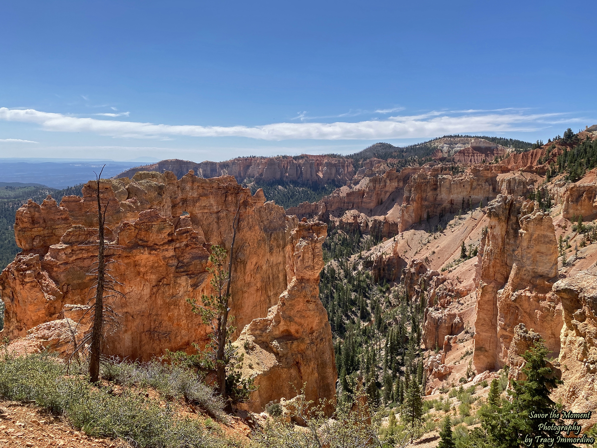
Rainbow Point is located at the southern end of Bryce Canyon Road in Bryce Canyon National Park, Utah.
At 9115 feet, it is one of the highest elevations in the park.
You can access the Bristlecone Pine Loop trail from here.
…
Bryce Canyon National Park spans 35,835 acres. It is open year-round, 24/7.
We started our adventure at Sunrise Point located off the Rim Trail between Shuttle Stops 12 and 13. There are parking lots located here as well, but this is a popular spot, and they fill up quickly.
…
I highly recommend taking National Scenic Byway 12 from Capitol Reef National Park to Bryce Canyon City. There are a multitude of beautiful scenic viewpoints to visit along the way.
Our first scenic stop, along the route,
…
Capitol Reef National Park, located in Utah, is 381 square miles.
We arrived in the park from Scenic Byway 24, on the east side.
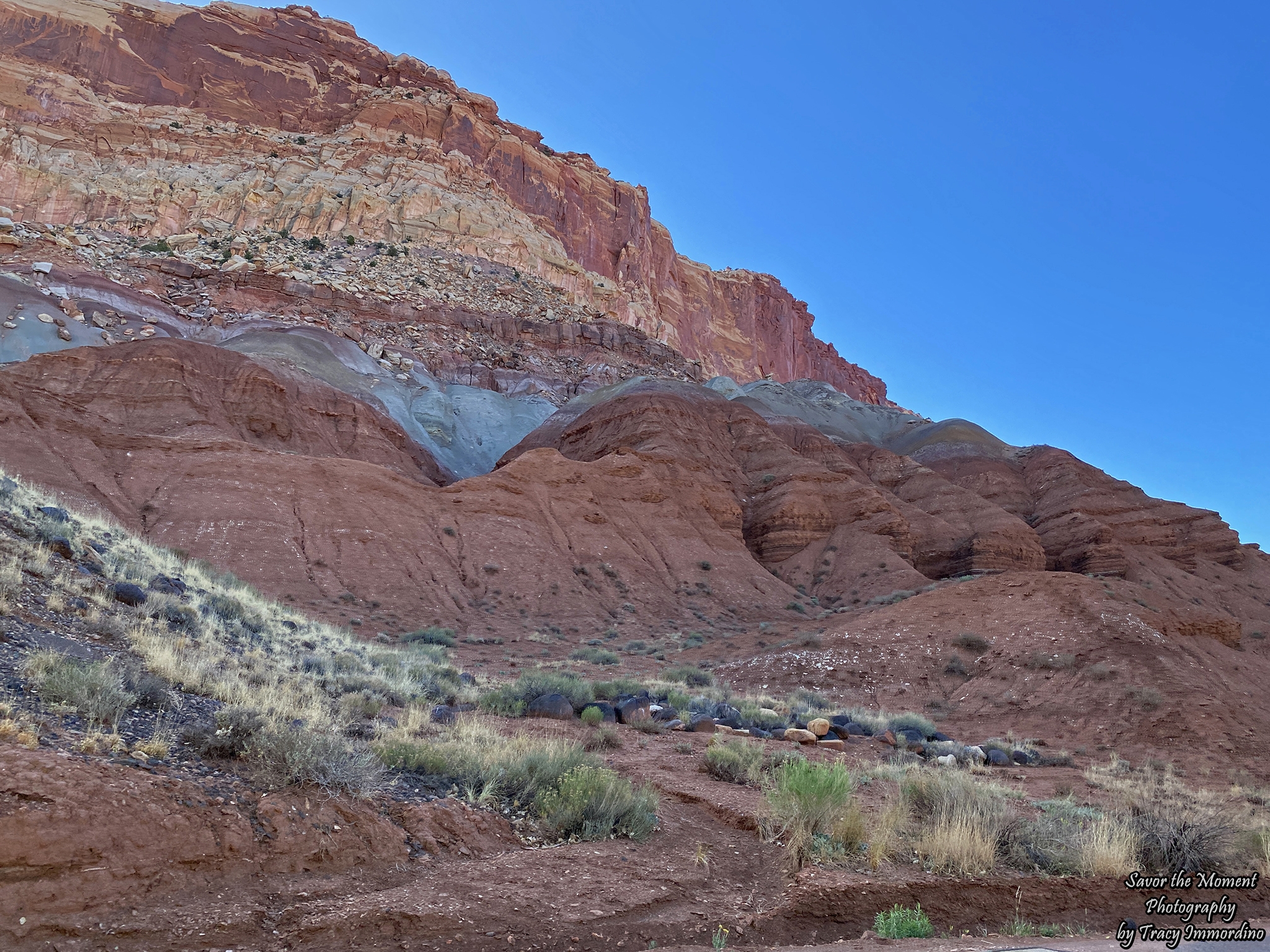 Capitol Reef National Park
The park protects the Waterpocket fold (seen above and below).
…
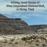
We decided to go a little out of our way in order to take Scenic Byway 24 to get from Canyonlands National Park to Torrey.
We did not make any stops, beyond getting gas, on our drive.
The trip was 175 miles and took us a little over three hours.
…
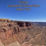
Canyonlands National Park covers 337,598 acres, divided into 3 districts. We chose to explore the Island in the Sky section.
Our first stop was the Shafer Trail Viewpoint. It offers a fabulous view of Shafer Trail.
This dirt road was originally a trail that was first developed by Native Americans to get up to the top of the canyon.
…
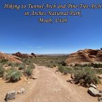
Tunnel Arch and Pine Tree Arch branch off from the Devil’s Garden Trail.
The hike starts from the parking lot near Devil’s Garden Campground. You will begin the hike towards Landscape Arch and take the spur trail, on the right, that leads to both Tunnel Arch and Pine Tree Arch.
…
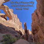
My favorite hike, during our short stay at Arches National Park, was The Fiery Furnace.
To hike in this area, you need a permit. The trails are hard to follow, and many people get lost.
We opted to do a guided hike with a park ranger,
…
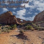
A quick and easy hike to tackle in Arches National Park is the Skyline Arch Trail.
The trail is .4 miles roundtrip. It’s a well-marked, there and back pathway, with an elevation gain of 28 feet.
We took 15 minutes from start to finish…would have been faster,
…