Bryce Canyon National Park spans 35,835 acres. It is open year-round, 24/7.
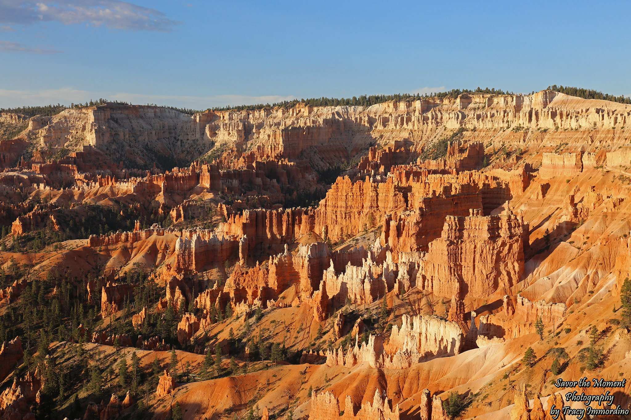
Sunrise Point
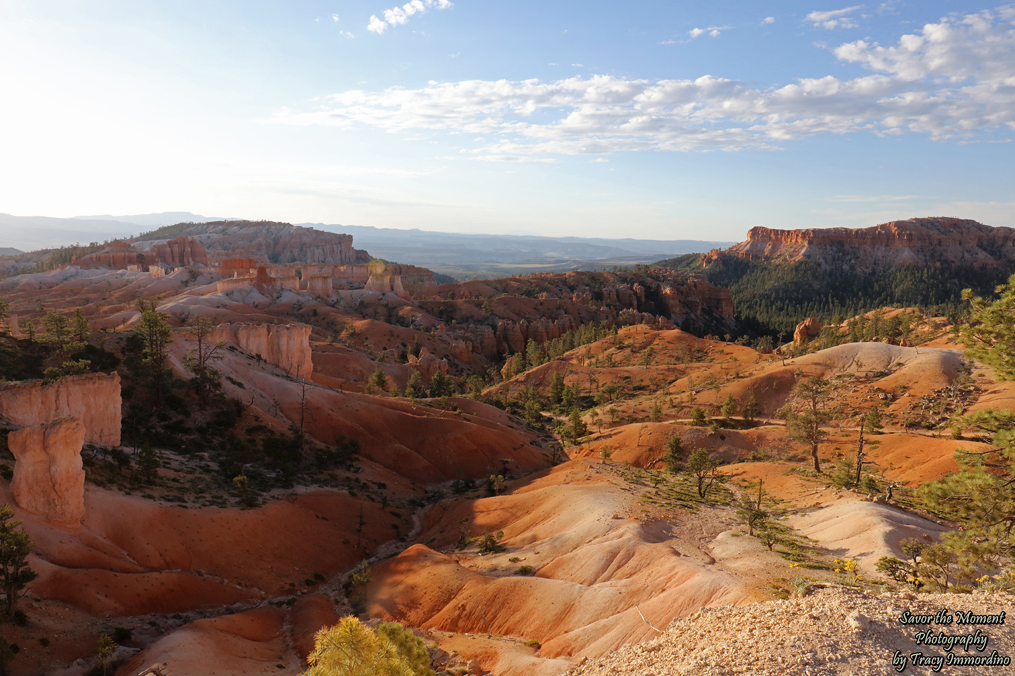
We started our adventure at Sunrise Point located off the Rim Trail between Shuttle Stops 12 and 13. There are parking lots located here as well, but this is a popular spot, and they fill up quickly.
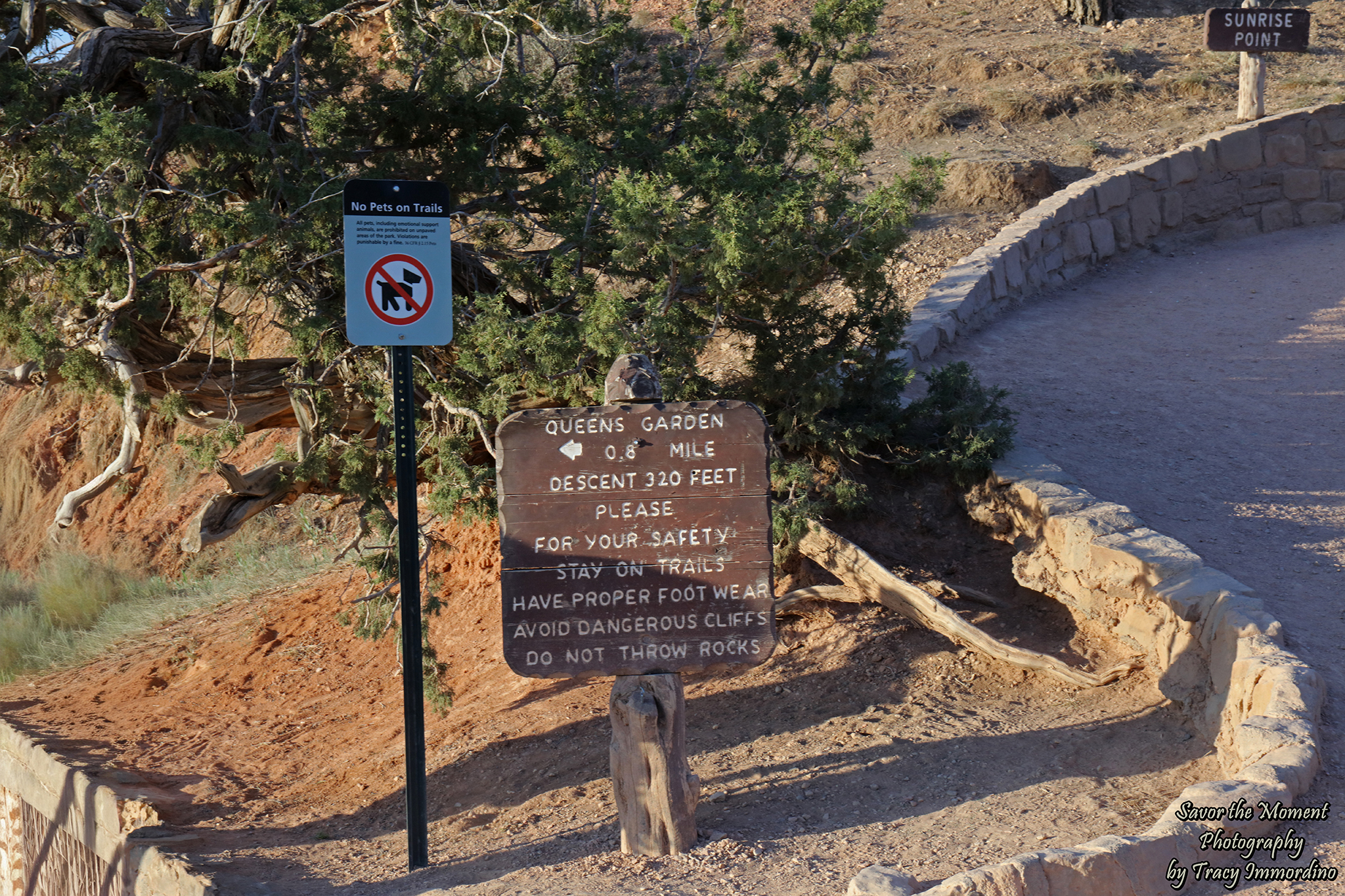
Queen’s Garden Trailhead
If you are only hiking there and back to Queen’s Garden – Queen Victoria Hoodoo Viewpoint, it is .8 miles each way and a descent of 320 ft. We choose to do the connecting Navajo loop as well, which in total is 3 miles, and you will descend and have to ascend 625 feet. Also, Do Not Throw Rocks! The sign must work, as we saw no one throwing anything at all. 😂
Queen’s Garden Trail
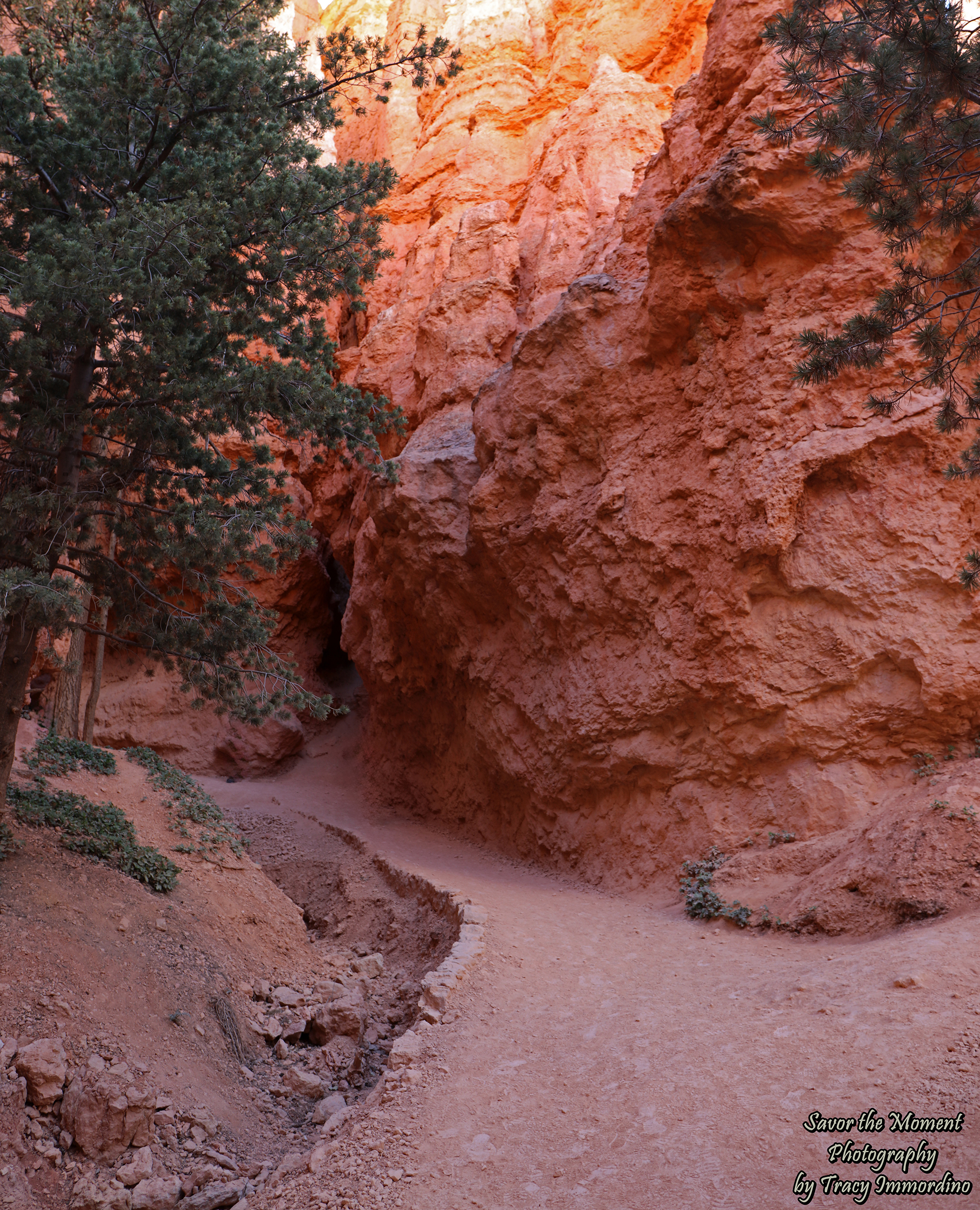
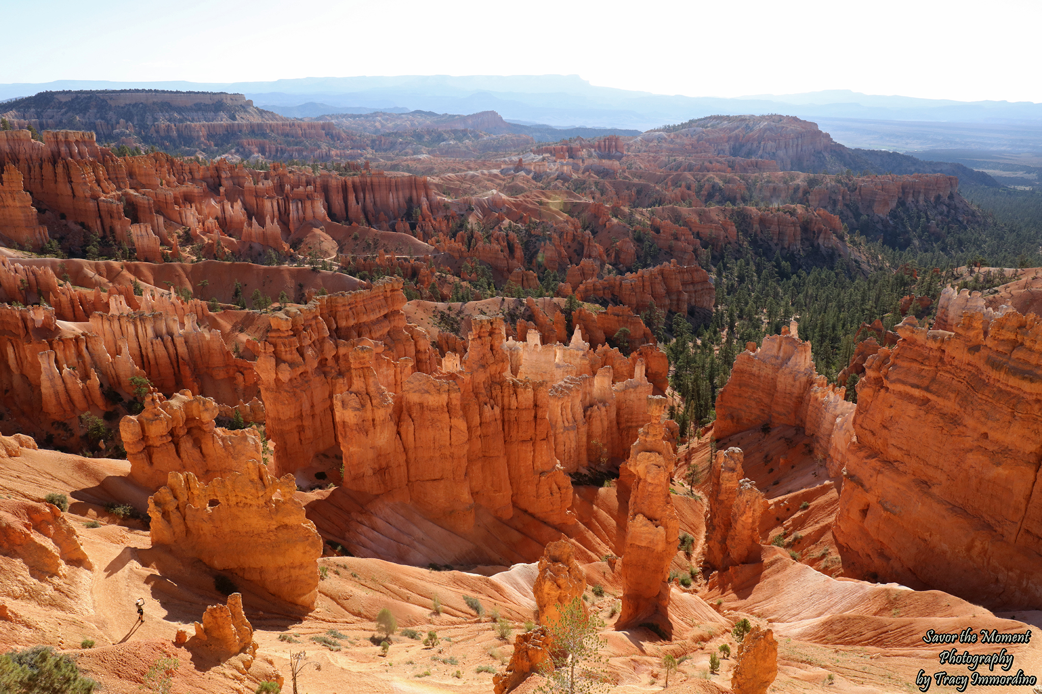
The hike descends from the rim into the Bryce Canyon Amphitheater. It is the most popular hike in the park.
Queen’s Garden Trail
We started our hike at 7 am, wanting to avoid both the crowds watching the 6 am sunrise, and the hottest part of the day.
Queen’s Garden Trail
We were able to stay in the shade for the majority of the hike. I highly recommend an early morning hike, especially during the summer, as the temperature can make hiking dangerous.
Queen’s Garden Trail
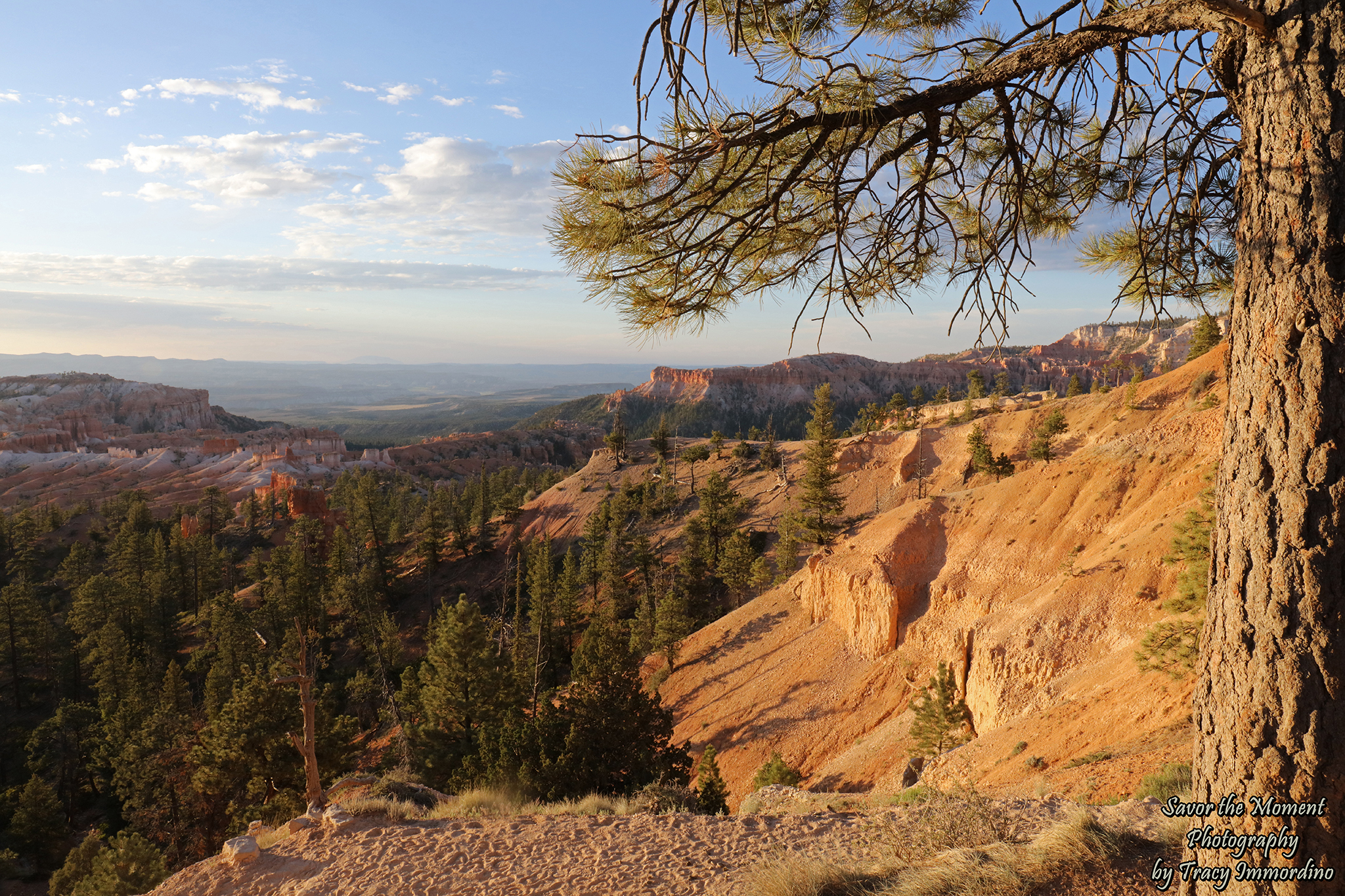
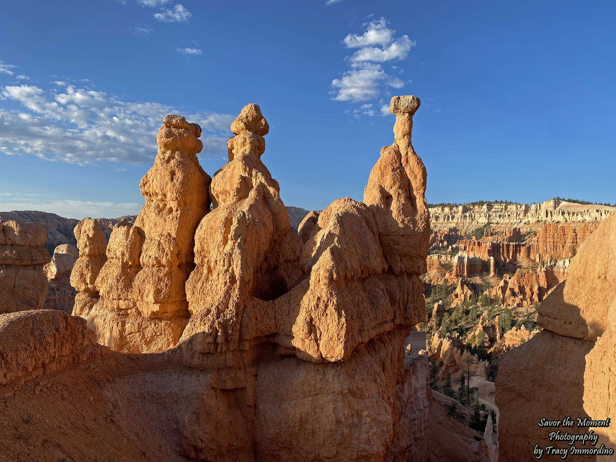
The rock seemingly changes color based on the location of the sun in the sky and its intensity.
Queen’s Garden Trail
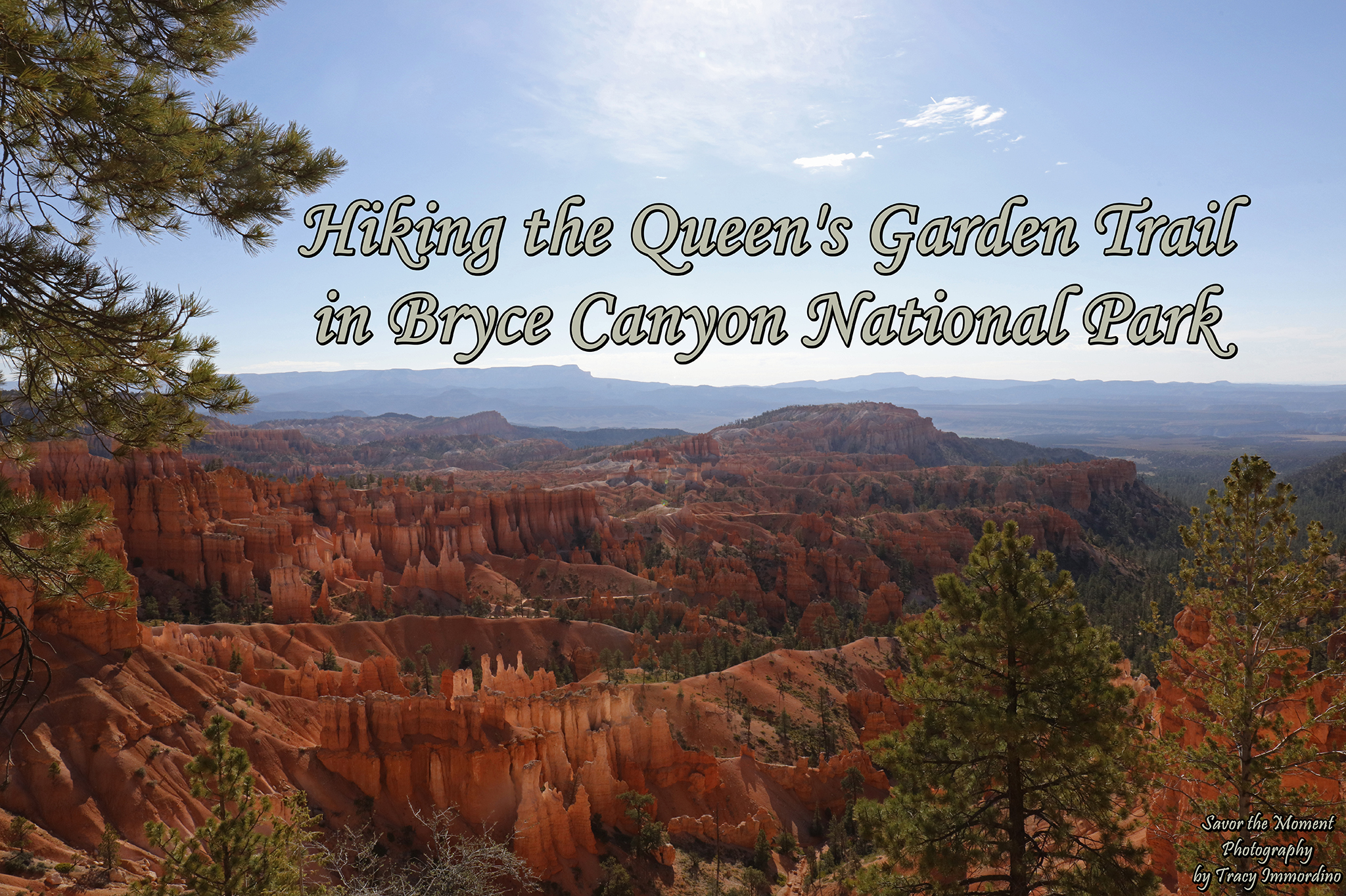
The scenery is spectacular; you see so much more on the hike than you can from the viewpoints.
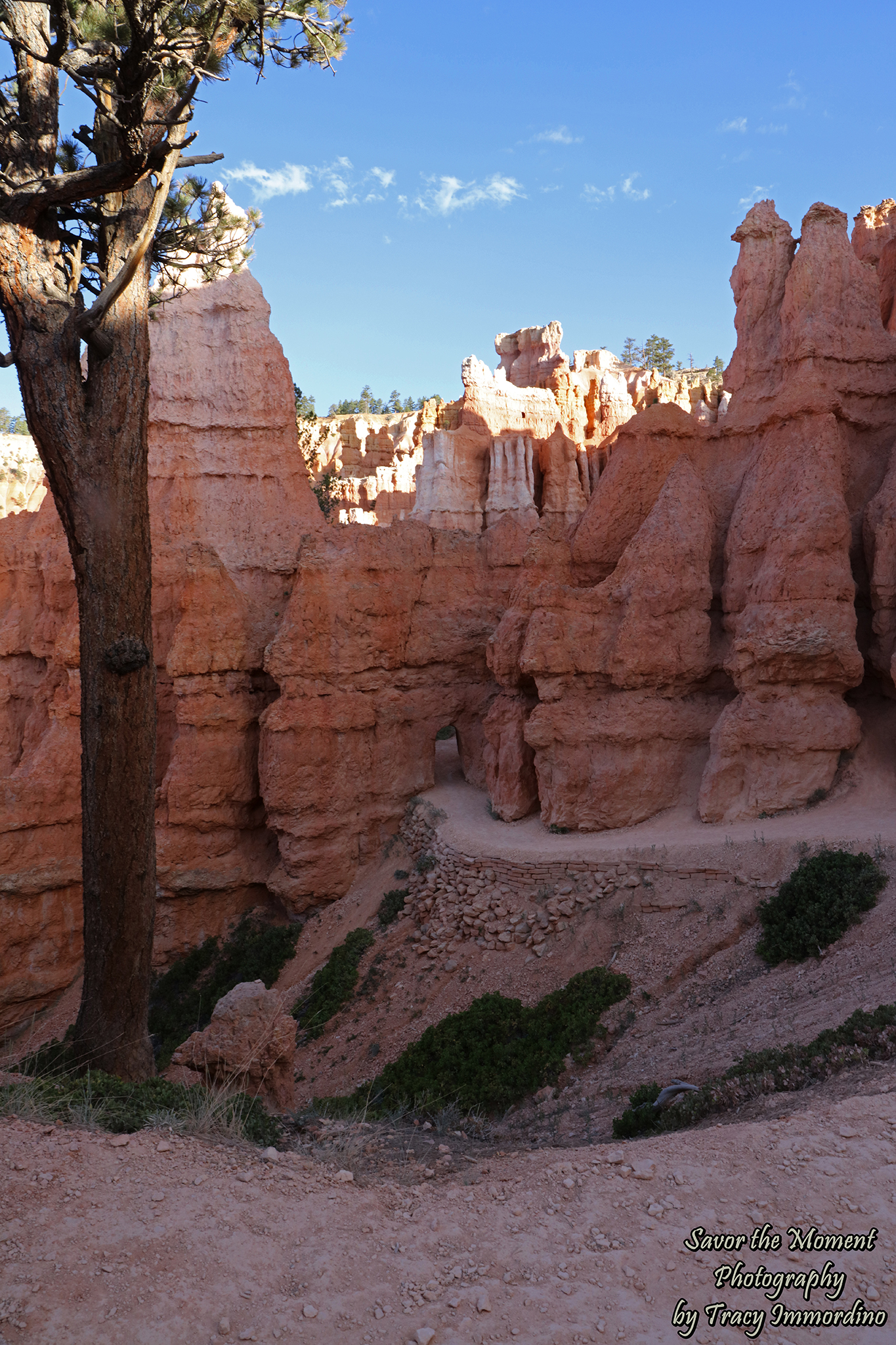
Queen’s Garden Trail
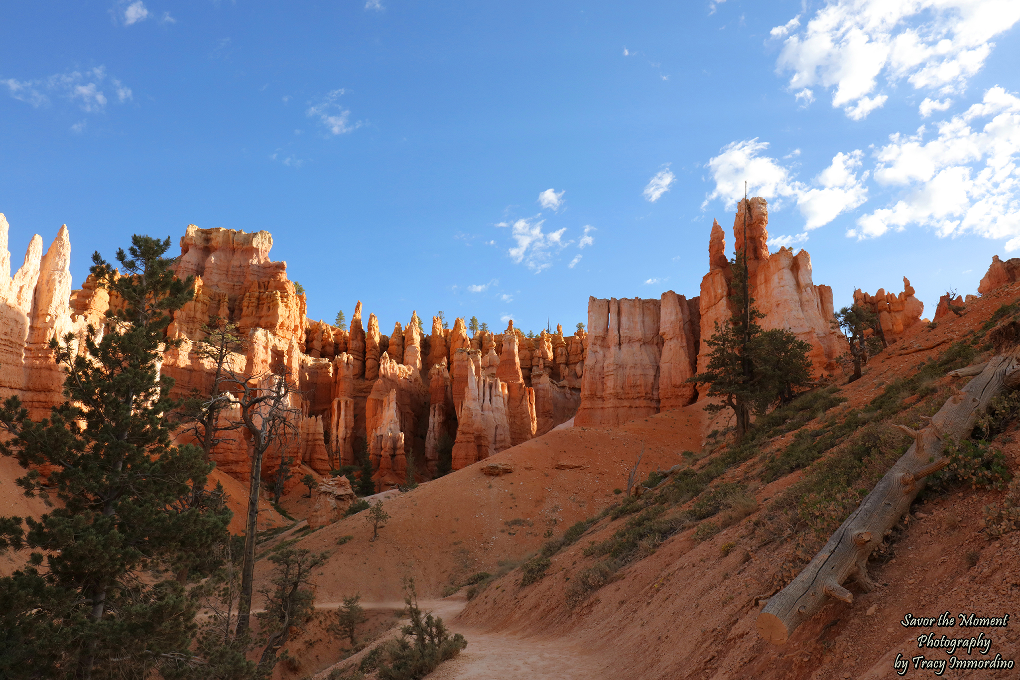
As the sun rises, the canyon fills with sunlight and heat.
Queen’s Garden Trail
If you start early enough in the day, the hoodoos and canyon walls provide shade as the sun is rising.
Queen’s Garden Trail
I kept pausing and thinking, this is my favorite view! Then, in another 100 yards, I’d stop again and think the same thing.
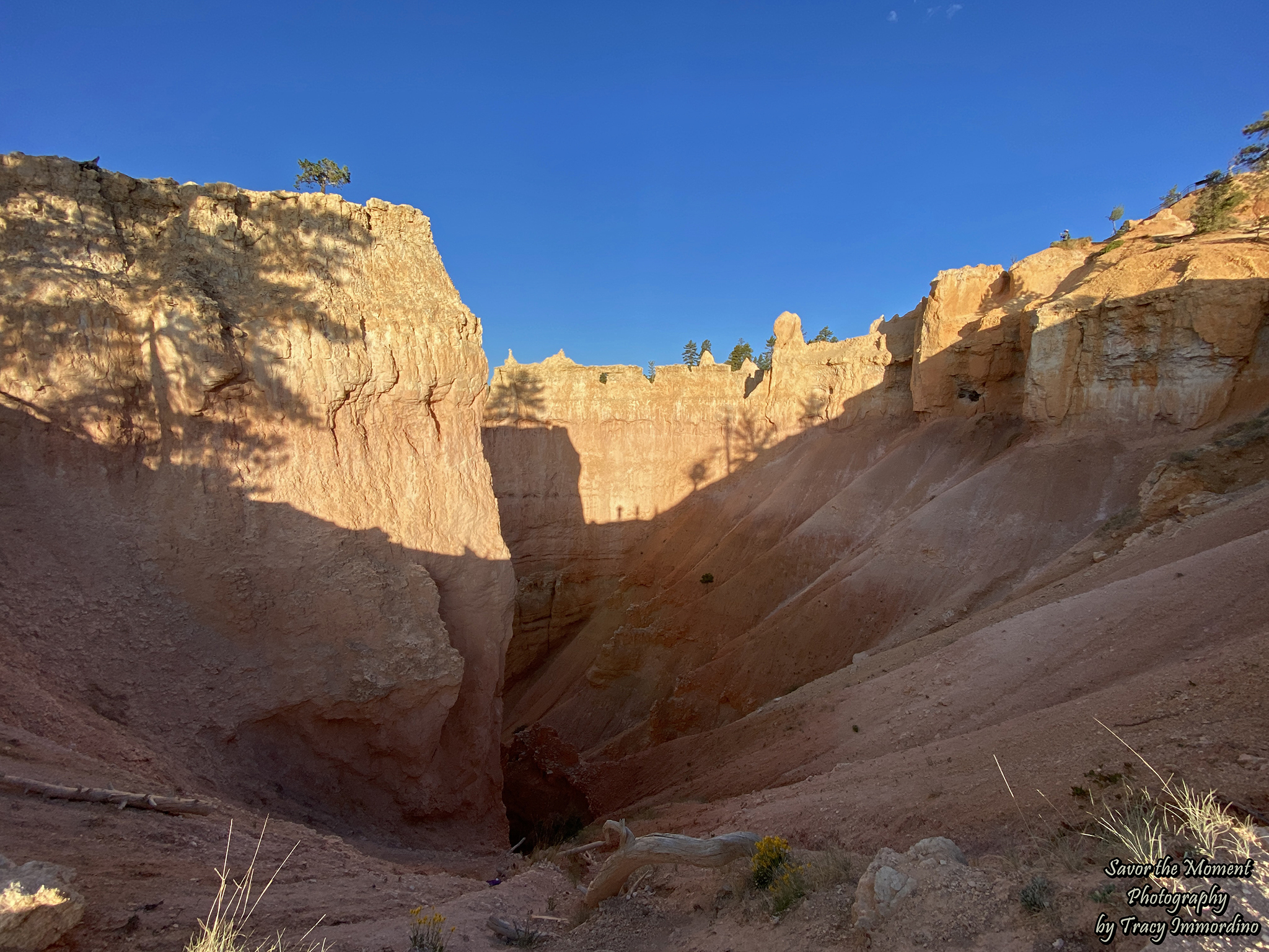
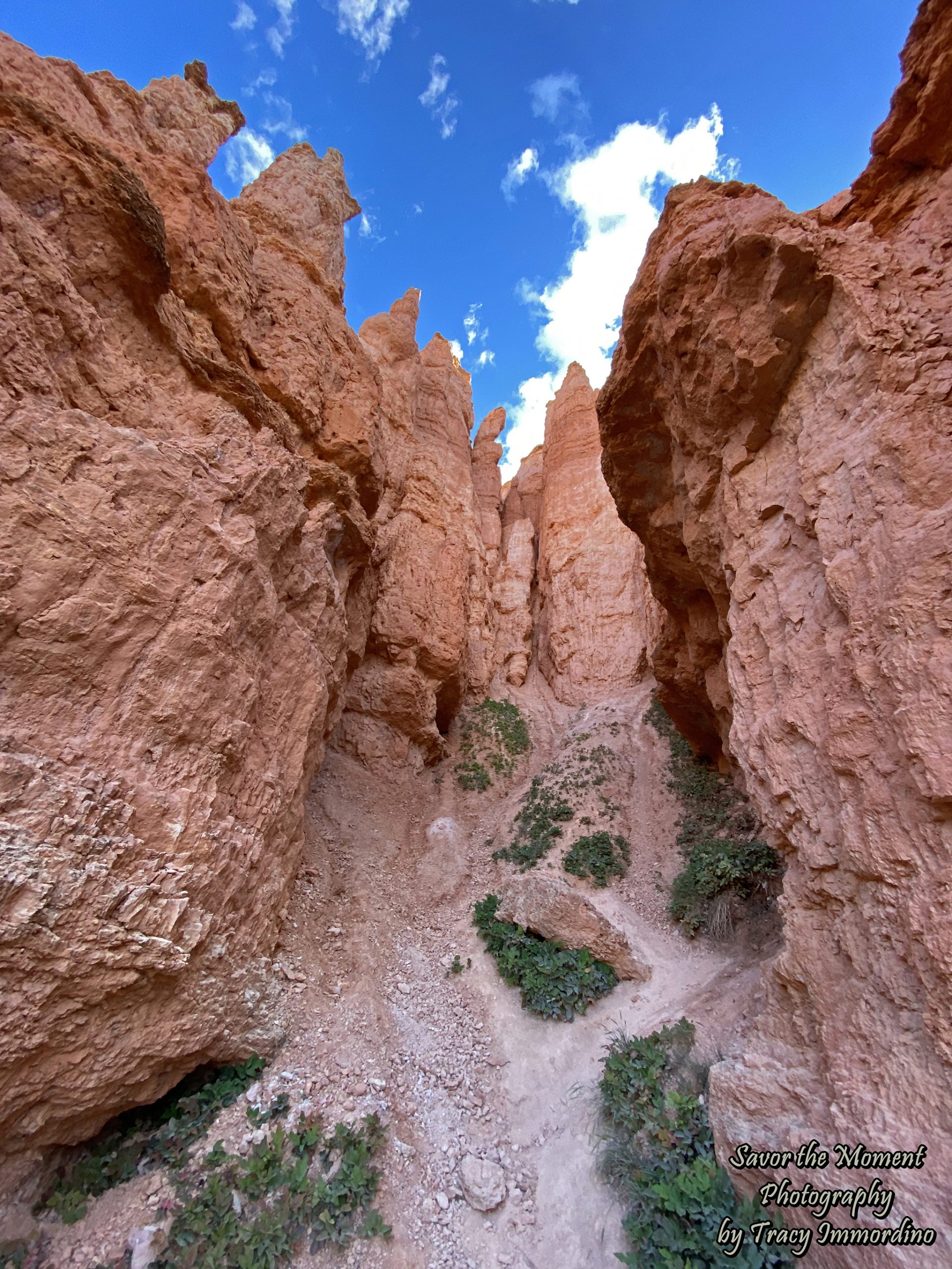
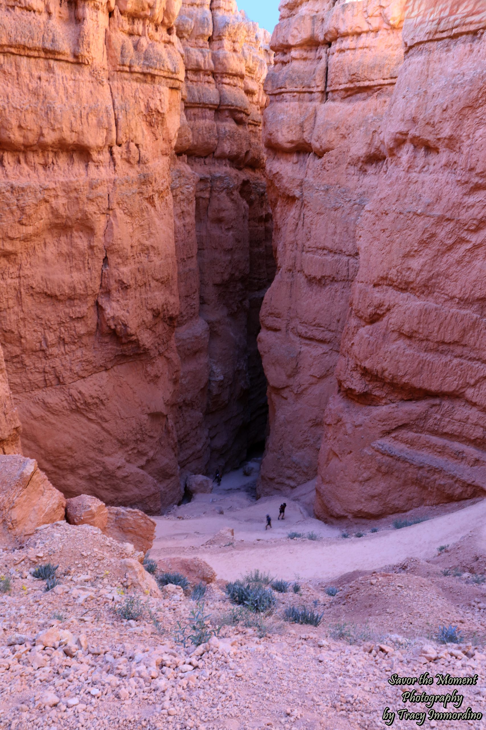
Navajo Loop Trail
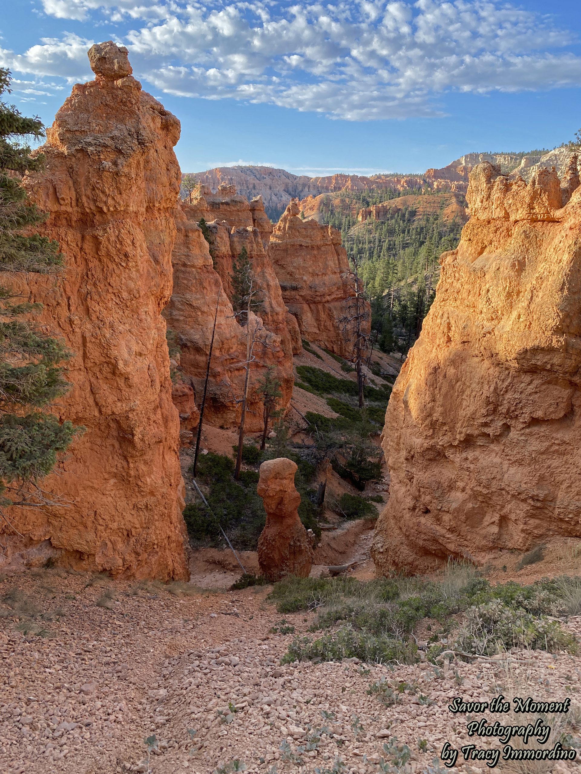
You are, and have been for a while, on the Navajo Loop Trail once you get to the slot canyons.
Navajo Loop Trail
Time to hike up 625 feet. Although the switchback makes it easier, it’s still pretty exhausting. Remember, you are at an elevation between 8,000 and 9,000 feet, so the oxygen level in the park is about 75% of what you’d have at sea level. Even my very fit 24-year-old son was taking some breaks on the way up, and not just because he was waiting on his parents.
Sunset Point
We ascended to Sunset Point and then finished off by taking the Rim Trail back to the parking lot at Sunrise Point. We loved this hike and absolutely recommend it.
Things to Know Before You Go:
- There are parking lots at both Sunrise Point and Sunset Point. They can fill up quickly, especially near sunrise and sunset. The Rim trail connects these locations and there is not a lot of shade along it. Take that into consideration when planning your hike.
- The hike is rated moderate and takes between 2 – 3 hours to complete.
- You can take the Shuttle Bus to both Sunrise Point and Sunset Point. We did not use the shuttle during our stay. If you wish to do so, you can click here to get more information.
- As of this writing, there are no reservations required to visit the park.
- On this trail it is recommended that you go clockwise, starting at either Sunrise Point or Sunset Point for the best views as you hike.
- The park ranges from 8,000 to 9,000 feet, so you will get winded more quickly, and altitude sickness has been a problem for some visitors. Your lungs and heart will have to work harder and you will dehydrate more quickly.
- Wear sunscreen, bring water and hike as early in the day as you are able.
- If you are unable to do the hike, the scenic viewpoints are amazing on their own.
- Check out the National Park Service website for a wealth of additional information.
Afterwards, we had breakfast at the Bryce Canyon Lodge. The restaurant is nice, the food is just ok, but our server was hysterical and delightful. In fact, if we had been staying longer, we would have returned just to see him again. We then drove to the end of Bryce Canyon Road and stopped at all of the scenic overlooks on our way back. Doing this allows you to not cross traffic when entering and exiting the viewing areas. Our first stop was the Rainbow Point Overlook.
As always, wishing you happy travels and fantastic adventures in this thing called life.
(All pictures are available as Fine Art Prints or Digital Downloads for purchase through Alamy. If you see something you like, click on the link. If you are unable to find it, use the Contact Me page and I will make sure the image is available.)
More Hiking Adventures in Utah
Hiking Sand Dune Arch and Broken Arch Trail
Hiking the Fiery Furnace in Arches National Park
Hiking Tunnel Arch and Pine Tree Arch
Pin for later!
Queen’s Garden Trail and Navajo Loop