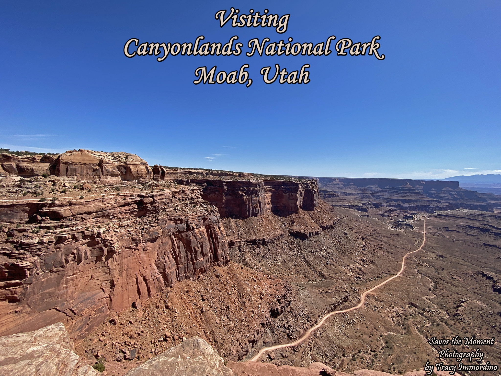
Canyonlands National Park covers 337,598 acres, divided into 3 districts. We chose to explore the Island in the Sky section.
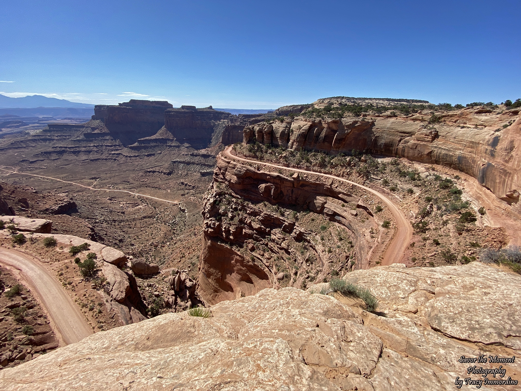
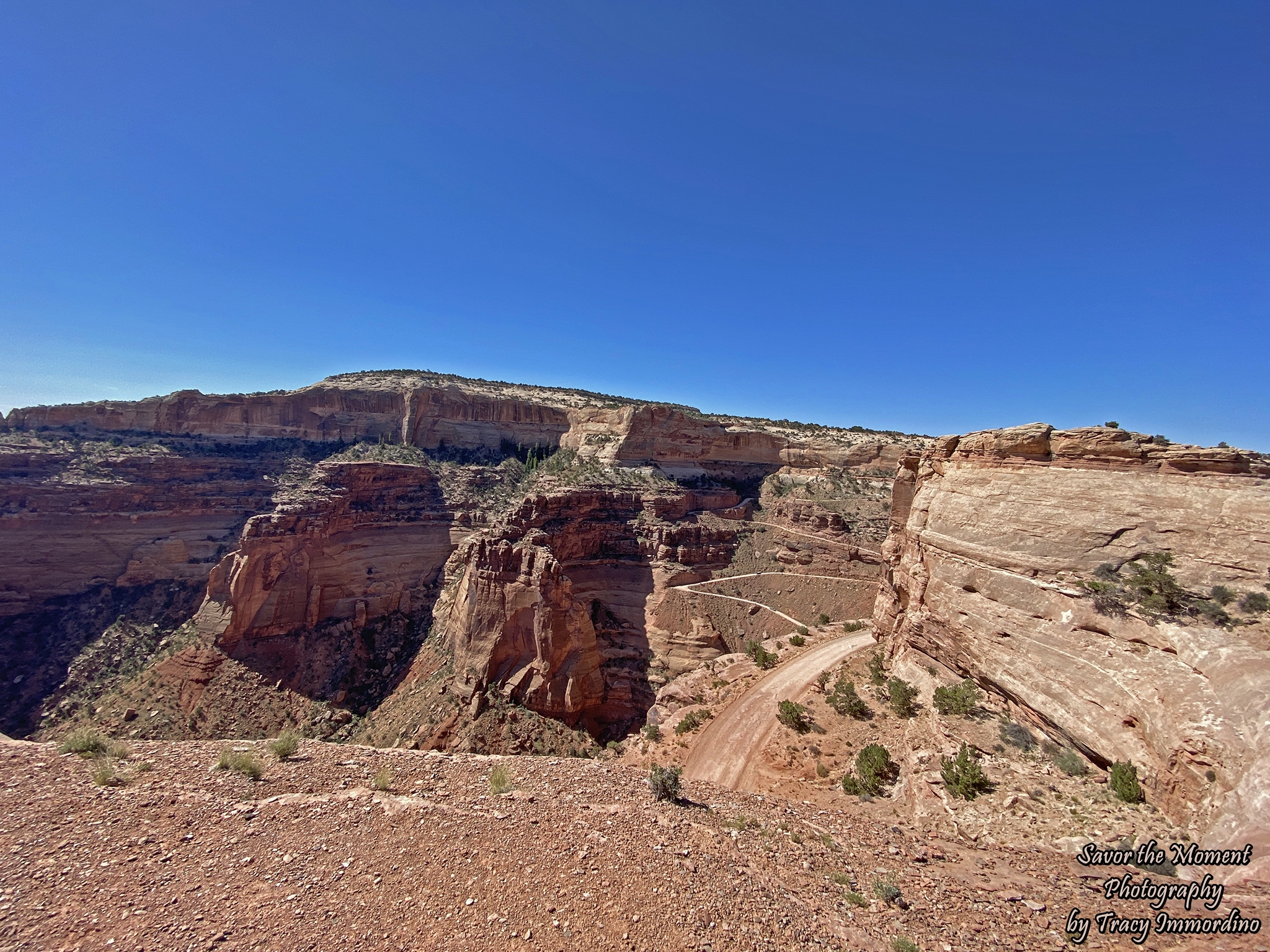
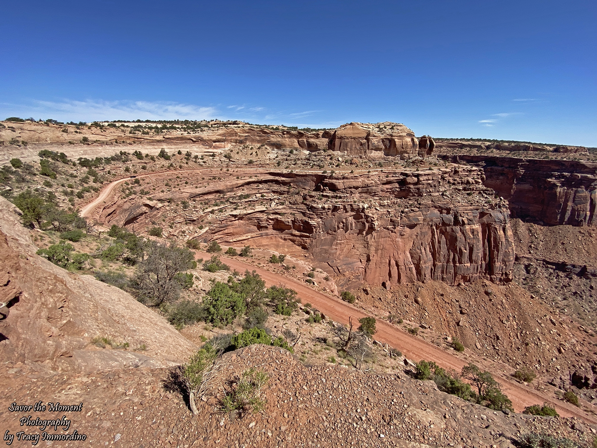
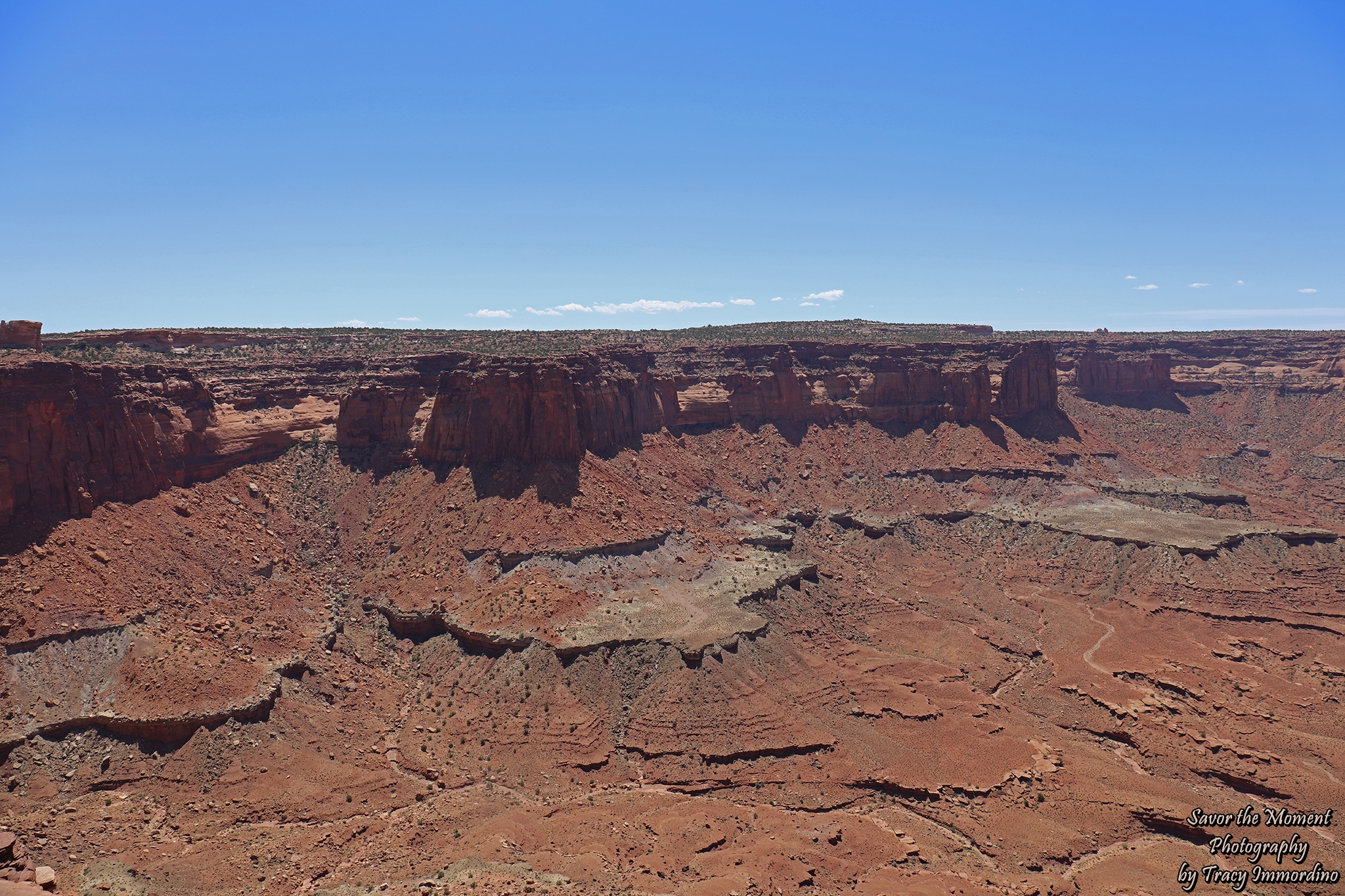
Shafer Road in Canyonlands National Park
Our first stop was the Shafer Trail Viewpoint. It offers a fabulous view of Shafer Trail.
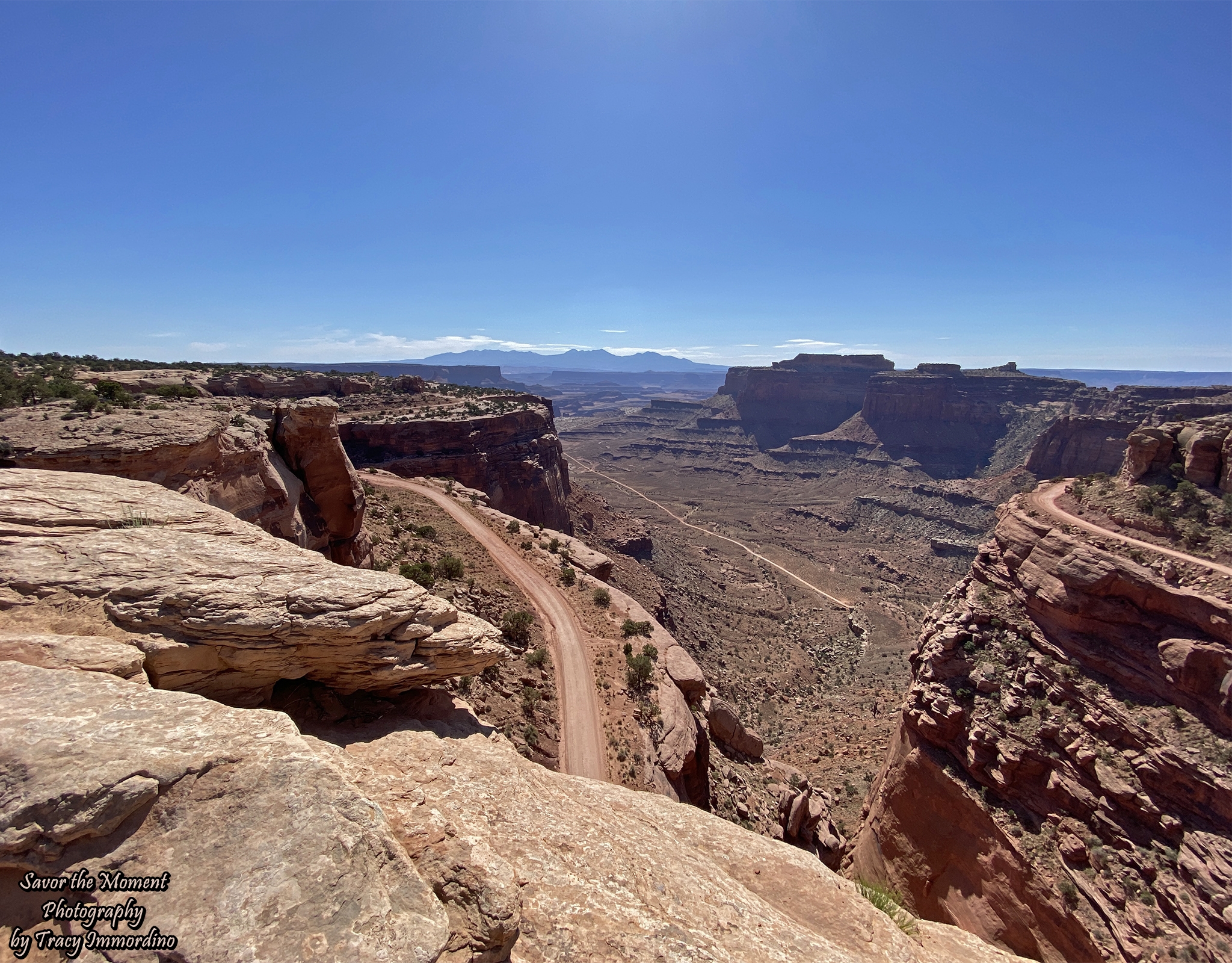
Shafer Road in Canyonlands National Park
This dirt road was originally a trail that was first developed by Native Americans to get up to the top of the canyon. It was eventually developed further, but still very rough, by the Shafer family, in 1916, to move their cattle from the pastures on top of the mesa to the canyon below for winter.
Shafer Road in Canyonlands National Park
The trail/road winds 1,500 feet down to the valley floor and eventually turns into White Rim Road (still dirt).
Shafer Road in Canyonlands National Park
I’m sure you can tell from all the photos I took, that I was captivated by this road. It is drivable, a high clearance 4 WD is recommended. My son, however, was not willing to risk his vehicle, which was wise, as it was not high clearance or 4WD. If we would have been in my vehicle, we would have gone on this adventure.
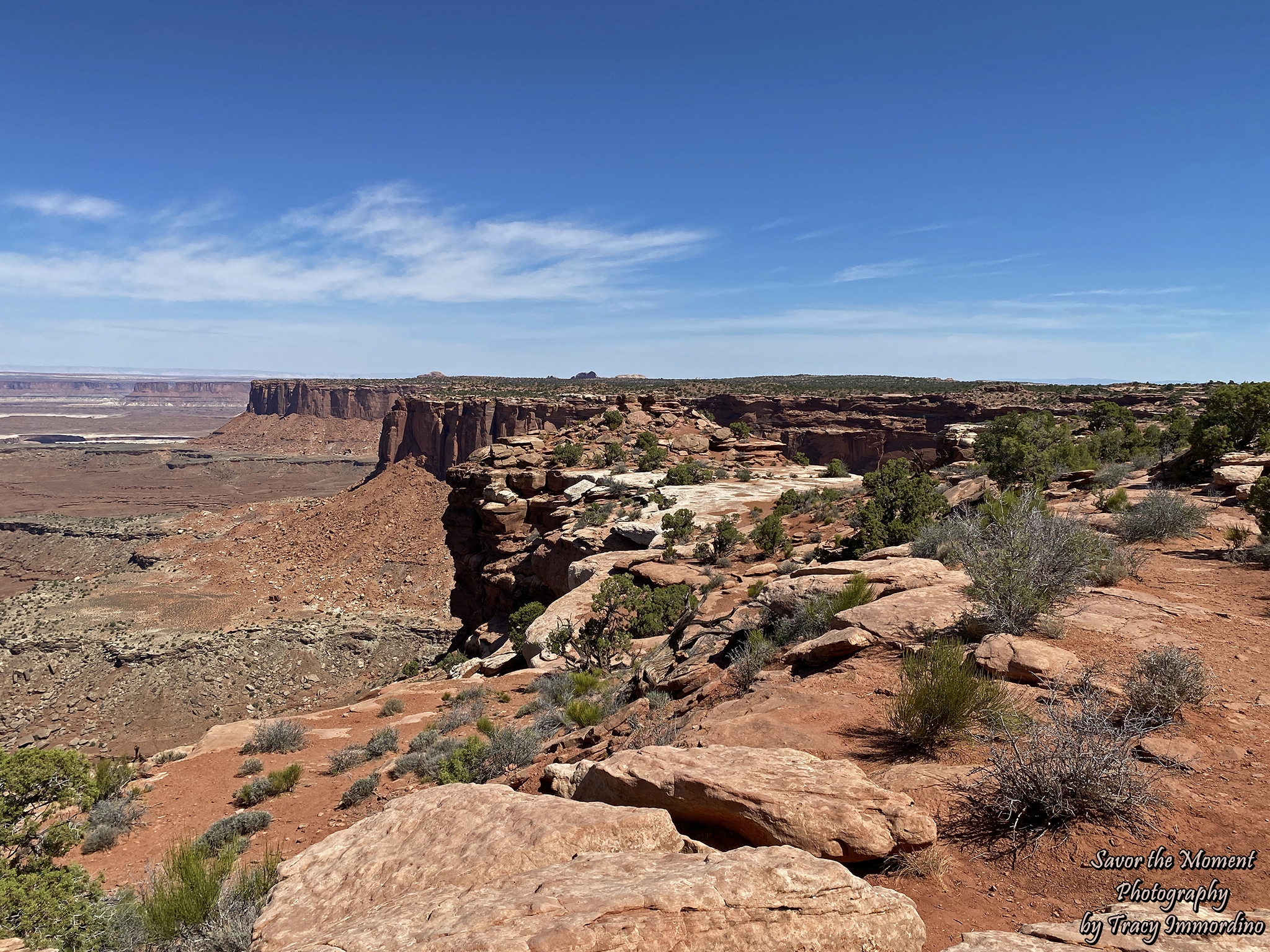
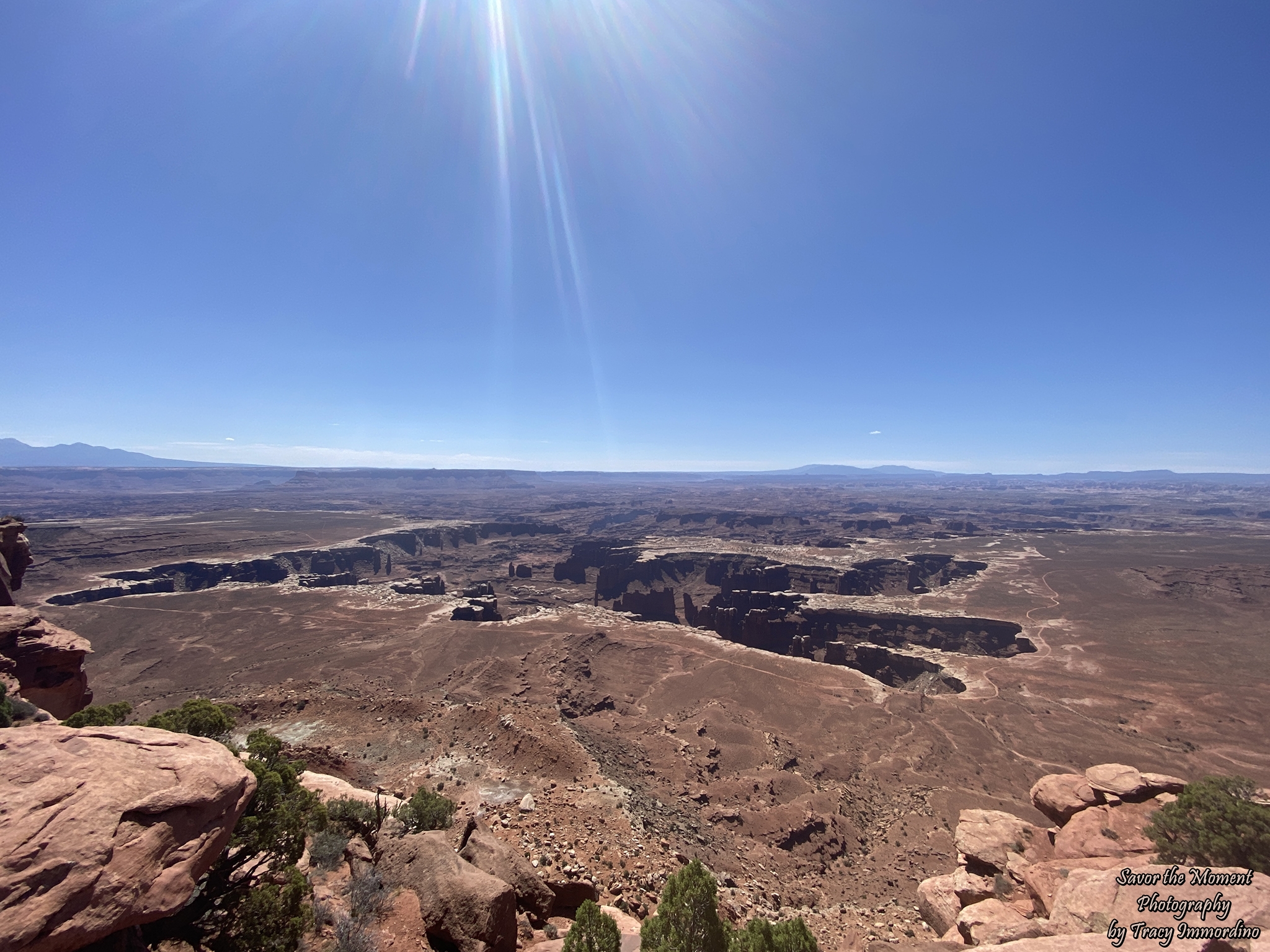
Buck Canyon Overlook
Further along the scenic drive is Buck Canyon Overlook. A short, paved walkway leads to the viewpoint, which is 6,240 feet in elevation.
Buck Canyon Overlook
This stop provides a view of the Colorado River Canyon. The park is designed so that you can get remarkable views and see major features of the park just by doing the scenic drive.
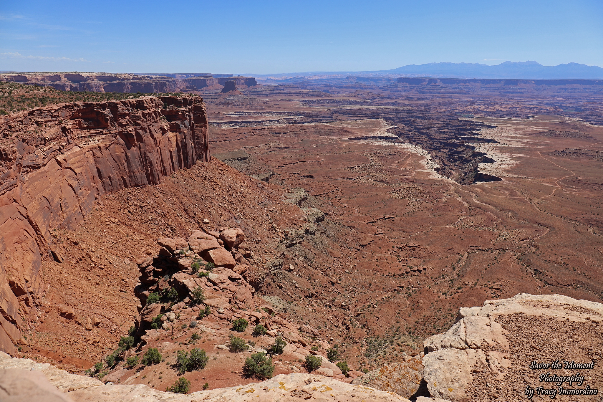
Grand View Point Overlook
Our next stop was at Grand View Point Overlook. This is the final viewpoint along the Island in the Sky scenic drive. A short, paved sidewalk leads to the viewing area. There is also a hiking trail here. The temperature was over 100 degrees during our visit, so we decided against the two hikes we had originally planned.
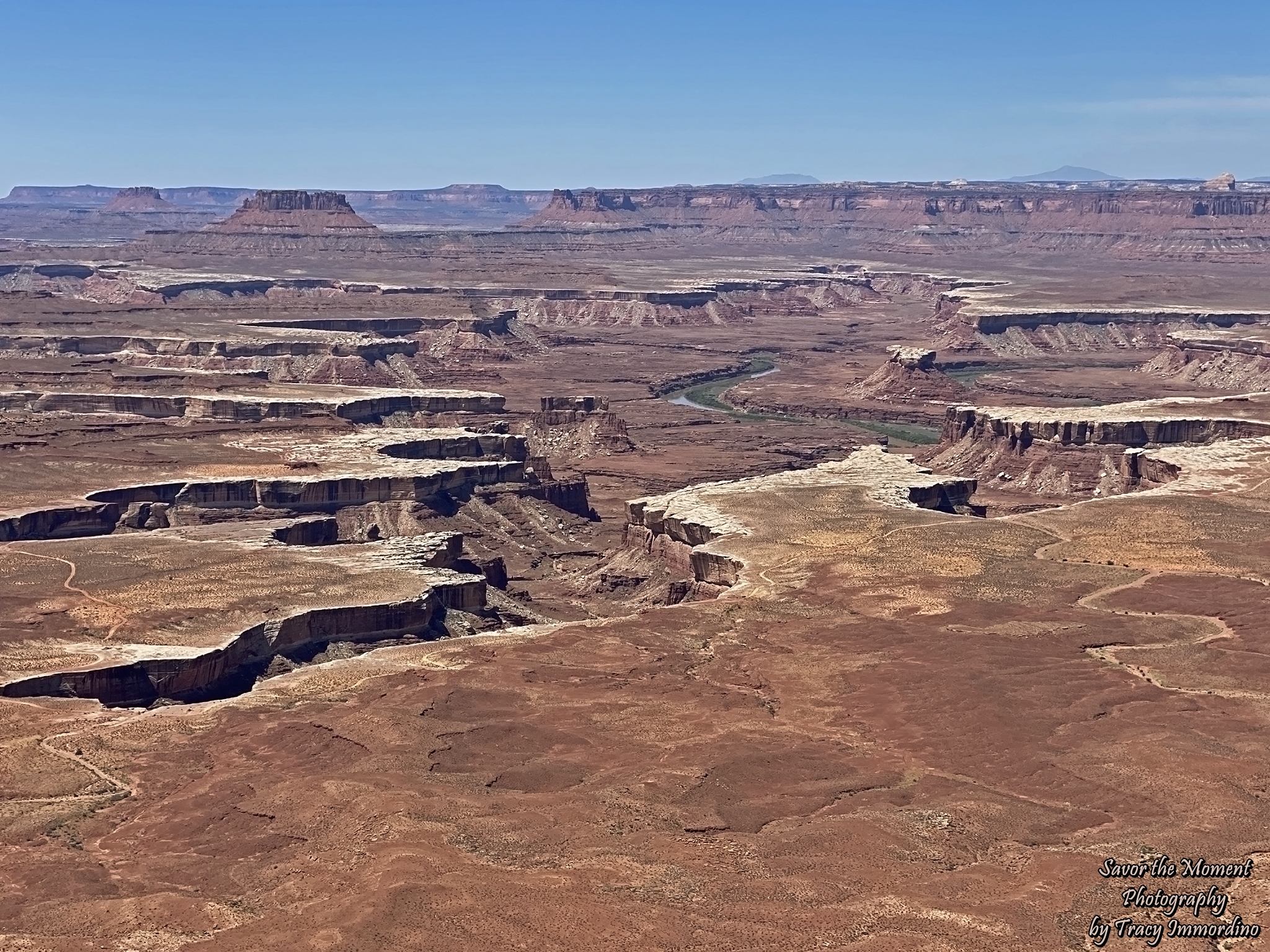
Green River Overlook
Our final stop in the park took us down Upheaval Dome Road to the Green River Overlook. The river truly is a vibrant color of green.
Green River Overlook
At this overlook, if you simply walk around and look in different directions, you feel like you are in an entirely different area of the park. At this point, we retraced our route to head out of the park. The four districts are not connected within the park; you must drive to each section separately. Each section can fill a whole day, and it can take several hours to drive to the next section.
Our time schedule required us to move on. We chose to go a bit out of the way to take Scenic Byway 24 to Torrey, Utah. It was so worth it! If you don’t get out of your car to take pictures, it takes a bit over three hours (with no traffic). As always, wishing you happy travels and fantastic adventures in this thing called life.
(All pictures are available as Fine Art Prints or Digital Downloads for purchase through Alamy. If you see something you like, click on the link. If you are unable to find it, use the Contact Me page and I will make sure the image is available.)
Things To Know Before You Go
- The entry fee is currently $30/car. They accept the America the Beautiful Pass.
- The park is open 24 hours a day, every day of the year.
- Reservations are currently (2025) not required to enter the park.
- The park offers scenic drives, hiking and camping. Camping is partial reservation, partial first come, first serve.
- Each district has its own Visitor Center.
- If hiking, be sure to have plenty of water, sunscreen, sunglasses and proper footwear. If possible, I’d plan your visit for spring, fall or winter, to avoid the most intense heat.
- Current information about fees, reservations, maps, etc. can be found here.
Hiking in Utah
Hiking Sand Dune Arch and Broken Arch Trail
Hiking the Fiery Furnace in Arches National Park
Hiking Tunnel Arch and Pine Tree Arch
Pin for later!
Visiting Canyonlands National Park